Showing posts with label TRIPS - LOGISTICS. Show all posts

Monday, July 31, 2017

HITCH CARRIER EXPANSION FOR THE AIRSTREAM INTERSTATE

Last year, I published a post trilogy (Parts One, Two, and Three) describing our EPIC struggle to obtain a hitch carrier that met our specific travel and family needs.  We ended up custom DIYing the best carrier that either of us have ever seen, bar none.
And our dog agreed. 
Fast forward a year and a nagging voice in my head kept saying, "Lady, yer gonna need a chain saw where yer goin' next!"  And the chain saw we picked requires a gas can.  And a gas can presents a serious challenge for carriage in a Class B camper van.
It was just a small gas can, a Wavian 2.5 gallon military spec steel jerry can, but still, it presented a big challenge.
I wanted to do something as simple as possible - maybe bolt it temporarily to the back of our existing hitch carrier, because it will only need to live there briefly during local trips when we were actually hauling a couple of gallons of gasoline to our property.  But my husband had other ideas, and due to the cuteness factor of this project, I could not find it within myself to object to his plan.

Basically, he built a custom bracket that bolts onto our existing carrier.

The secret to retrofitting this device, the need for which we had not foreseen when we designed the original hitch carrier, was to "hang" the bracket off that main structural member, and extend it out to the driver's side.
Close-up of those two main bolts.
The Wavian frame could therefore be bolted, in turn, directly to that bracket.
View from above, without the gas can in place. 
The result was just too precious for words.
The Yeti cooler had a baby!  And it looks like it was a mixed marriage because coolers don't typically give birth to jerry cans!
Of course I made a matching sun shield / modesty cover out of silver tarp for the gas can.
I used the same approach as for the Yeti cooler, described in Part 3 of that trilogy linked above.
#vansizedsewing
You'd almost think that we designed the hitch carrier this way, given the fit in the remaining space and the fact that the gas can does not extend one millimeter beyond the body of the Sprinter.
Couldn'ta planned it better if we'd tried.  
Anyway, mother and baby are doing fine, and I'm dying from the cuteness factor here.
Awwwww!!!  It's not often that I get to use the word 'cute' in a Class B context!

No, ours is way cuter than that.

Tuesday, July 25, 2017

PRODUCT REVIEW: LET'S GO AERO'S TENTRIS ARCRV

I'm intrigued by, but not convinced of, this new product called the Tentris ArcRV.
It's a tent-like structure designed to expand RV living space.  Reportedly, the fit has been optimized for a Sprinter.  Photo from the Let's Go Aero website.  
Many have asked what's the best way to expand the sleeping and living space in Class Bs such as the Airstream Interstate.  There are a number of exterior room-like options on the market, and this one does seem to offer the advantage of packing down to a sufficiently small bundle for carrying in a Class B, plus its dimensions were reportedly optimized for the Sprinter.  And its weight of 24 pounds is not obscene.  

However, I question why a solid nylon enclosure would be needed.  It certainly won't hold a bit of heat with it being the massive size it is (said the old backcountry tent camper), and while it might protect its occupants against rain, its deployment leaves the open doors (either rear pair or slider, depending on where it is installed) vulnerable to getting their inside finished surfaces soaked and ruined.  One would have to develop some serious door protectors if it were to be used in rainy conditions.  And that would add cost and weight.  Plus a DIY commitment of time and materials because there's no product like that on the market right now.
I made stop-gap protectors for our Sprinter out of heavy-mil contractor trash bags that slip over the door tops, but obviously they don't protect 100% of the door.  When I first posted this pic on the Air Forums Small Space Living thread, I prefaced it "Caution:  Content may trigger intense Jeff Foxworthy flashbacks."
:-)
Well, one could say, this Tentris ArcRV provides privacy, at least.  But anyone sleeping outside a Class B in a tent-like contraption is likely to be children or teenagers, and I'd wonder how much privacy they really need at an individual campsite that presumably is reasonably private to start with?

I'd prefer to see more practical awning expansion options take the place of something like the ArcRV.  A permanently-affixed awning is already delivered with almost every Class B that is sold today, but it never has been properly exploited for its living space expansion potential (the expansion products that are on the market were not optimized for Class Bs or vans - they are generally too large, too heavy, too cumbersome, and they don't fit).  That's why I created an awning screen that actually could be used as an overnight camping structure in both fine weather and in certain light rain scenarios (as long as it wasn't a blowing, stormy rain) without leading to the ruination of the inside finish of the slider.
You might get away with leaving the slider open, although you'd have to be mindful of the passenger pillar perhaps getting wet... maybe you'd want to supplement with a nylon ground cloth positioned in that area for added protection.  
And my contraption certainly packs down smaller than the ArcRV.
Plus it weighs only one-tenth as much.  
Anyway, my point with this blog post is hopefully to stimulate the development of additional aftermarket ideas.  I'm not in a position myself to get into this area on a commercial level - I'm a simple DIYer who invents stuff as a hobby.  I think that this product, the ArcRV, will fit the needs of certain customers, but still, I would like to see the loose ends such as rain protection addressed, and more options available overall for this kind of space expansion product.  Personally I think the market is there - it just hasn't been properly developed yet.  
Sometimes it takes its own bloody time, though.  

Wednesday, May 24, 2017

ASIDE: DON'T SEE LIKE A TOURIST

I'm writing a non-van-related post here partly because I'm stuck outside the Halifax Nova Scotia airport with my return flights to Houston delayed at least 8 hours.  This type of delay has been so common in our experience - during one memorable year, our Houston to Halifax flight-related vacation delay amounted to FOUR DAYS plus seven hundred dollars in extra expenses that United Airlines refused to refund to us (our flight cancellation occurred at the halfway point which was Newark Liberty airport and so we were stuck there paying exorbitant hotel and taxi fees) - that it was largely the original inspiration behind our Airstream Interstate purchase two and a half years ago.  My best-case door-to-door travel scenario right now is 18 hours, and it very well might be longer (and often is... EDIT:  It ended up being 22 hours on this day).   With air service being that bad, why not drive?  It's only 40 hours up here by road, not to mention one hell of a lot cheaper, especially if you Crackerdock along the route.

Anyway, do you ever read blog posts about someone's travel adventures only to end up with an urge to slap the blogger?  They shallowly oooohh and aaahh about the exact same crap that every other tourist sees, and you end up concluding, "There's ten minutes of my life that I'll never get back" because you regret taking the time to read the post.

I don't want to fall into that category, so what I'm going to do below is present a photo tour in a non-stereotypical way.  So maybe it's still a time-waster, but at least it's not cut out of that same tired cloth.  A little less mindless tittering, and a little more perspective and magic realism, perhaps.

The most rewarding travel is all about seeing the more subtle details that many other people miss.
Like the color of the water, for instance.  The northeastern coast of Cape Breton was experiencing unusual gale-force winds, to the point where many lobster traps were destroyed and valuable pre-spawning lobsters killed.   That part was a bad thing, but the same conditions turned the seas a shade of sapphire that I have rarely seen.  This is the coast at Louisbourg with no photo enhancement.  

And it made a particularly vivid juxtaposition with the colors of the land. 
Including the lichens. 

I grew up 20 miles from Fortress of Louisbourg National Historic Site, so its novelty wore off for me about half a century ago.  But choosing to see it on opening day 2017, which happened to coincide with Victoria Day, when it was candidly exposed and not really ready for seasonal prime time, was a new experience.
It only opens during the tourist season, and winter damage from that wild, wild sea was visible everywhere.  The area experienced an unusually late spring, so pre-tourist repairs were behind schedule.  In this location, the sea had blasted through one of the canon portals and scoured out the base of it.  Discombobulated lumber was scattered everywhere.  
With no animators and almost no visitors present, the photographic opportunities were unprecedented.  The faithfully-reproduced scenes from the year 1750 were vacant and smelled unusually authentic, given that they had just been re-opened after a winter of hibernating under wraps. 
Of course there are no electric lights in the reproduction buildings.  Just an eerie glow of ambient daylight. 

The animators (costumed interpreters) were not yet on the job, but the management staff had loaded in some of the smaller livestock, which was still getting itself oriented.  Some animals were running at large, like this guy in all his typical rooster attitude.
One of the period buildings in the town.
I don't recall another time when I was able to take a picture of the main fortress chapel without having throngs of tourists below.  
On all of our trips to Nova Scotia (where I still have family), we always resolve to do at least One New Thing.  That way it doesn't feel like the same trip year after year.
And this year that one new thing was the Pomquet Acadian trails, some coastal hiking trails situated on a headland in geology with which I am much less familiar (I did my first degree, a Bachelor's in geology, here in Nova Scotia).  The trails are located about 15 minutes north of the Trans Canada Highway, just before the town of Antigonish.  I had to drive by this area anyway, coming back down from Cape Breton to the Halifax airport for my flight. 
Despite gale force winds, it was an interesting time to visit this area, as life was struggling to emerge in late spring conditions that were rather hostile.
Maple leaves start red, turn green, and then end red several months later. 
Buds everywhere.  I don't know what this is. 

I do know what this is - an orchid, which Nova Scotia has in abundance. 
More new growth.  This reminds me of baseball players signalling each others, when they will hold three fingers pointed at the ground.  
I had never seen an ant bed this large in Nova Scotia.  My foot for scale.  When we were children, we called these things "black ants" and didn't fear them as much as the province's bad-tempered "red ants", which use their massive mandibles to bite at every opportunity.    
Black bear scat.  There was a large fresh deposit distributed around the trail, of which this was one cohesive nugget.  It did not stink, suggesting that the bear had been eating green vegetation alone, which makes sense because nothing else is growing right now (when they start varying their diet later in the growing season, it gets pretty pungent).  I've never seen a bear in the wild, but I believe that day will come.  There have been too many close encounters, too many times when I've seen fresh scat, or fresh paw prints, or even smelled a bear just out of sight in the thick woods.  They're everywhere here.  
Maybe she was eating some of these - new ferns about to unfurl. 
Nova Scotia has been hit by a number of hurricanes and tropical storms lately, not to mention northern storms in winter.  Most of the softer (i.e., soil-rich) coast shows conspicuous damage.  
And this location was no exception.  There's that cliff erosion.  
There were bits of smashed lobster traps scattered way back into the coastal forest. 
It almost looks like the cliff-dwelling trees are begging the sea to take them and finally put them out of their erosional misery, as they strain and gesture toward it. 
The weather was extremely unsettled - I picked a good location for the hike because the Pomquet headland blocked some of the most severe winds.  But the view out over the water revealed this ominous blackness at the horizon.  
This area had more sedimentary rocks than many other coastal locations with which I am familiar, but the beach melange was very typically Nova Scotian, combining lithologies from hundreds of miles around.  And how is that possible, you may wonder?  In a word, glaciation.  As I took this picture, I acknowledged to myself that it's no wonder that so many people can't visualize climate change being a largely natural process - they didn't grow up as I did, surrounded every moment of every day with the incontrovertible and overwhelming evidence of the extraordinary magnitude of glaciation, and the fact that the natural sea level varied anywhere from 246 feet below to 330 feet above its present level (PDF link).  That historical climate change, and the glaciation triggered by it, is the primary reason why Nova Scotia ended up with the natural beauty that it has, which, in turn, is why it attracts over $2 billion per year in tourism revenues, despite being a small province with a population of only about 943,000.  Most of those tourists walk upon shores like this one with no clue as to the significance of what they're actually seeing.  We have poor public science education to thank for that. 

Tuesday, April 25, 2017

SEA RIM STATE PARK AND FOUR NATIONAL WILDLIFE REFUGES

Yet another of my whirlwind tours, this time of the upper Texas coast rather than south Texas, and here are some pics and anecdotal comments.

(1) TRINITY RIVER NATIONAL WILDLIFE REFUGE

With 30 million people in Texas but only 1.8% of Texas land being federally-owned (PDF link), you can bet that, at times, things get a little strange around here.  Every federal installation has serious access pressures and some discretion to enforce its own rules, balancing the wildlife preservation mandate against public interest and pent-up demands of too many people who have too few public spaces available to them.  For that reason, policies are variable and access is unpredictable at best, if it exists at all.
The weirdness starts with Googlemaps, which doesn't even name or label portions of this particular refuge (shown anonymously in green above).  The NWR's web pages are no help, because they simply direct the public to "contact the refuge".  But then of course if you try to "contact the refuge", you'll be hard-pressed to locate anyone.  And then if by some miracle you do locate someone, the answer is often "no".  
We drove up to Trinity NWR to see what we could find, and the answer was a big fat nothing.  That trace on the Googlemap called Camp Road wasn't even a public right of way.  There were signs warning of imminent death if one chose to trespass on private property.  Which had every appearance of being federal land, but let me not go off on that tangent.

So, we decided to leave that one for future sleuthing, and we moved onward to our local coastal jewel, the sure-thing known as...

(2) ANAHUAC NATIONAL WILDLIFE REFUGE.

I blogged about this place last year, and it is a gem.
Shoveler Pond. 
A portion of Shoveler Pond at sunset.  I see lots of mountain majesty on Instagram, but we don't have those kinds of massive natural features on the Gulf Coast.  We have to look for the beauty in little things, like sunset colors. 
I say "we" because this short journey started on a Sunday, and my husband and dog followed behind me.  He had to go to work Monday morning and so did I, but my assignment was in Beaumont Texas rather than near our home base in Houston.  Sometimes we do this.  We travel locally and take two vehicles, and then he leaves when it's time to sleep.  It's imperfect but it's the life of working people.  At least this way, I get to spend time both outdoors and with my loved ones. 
Lily pads in Anahuac.  Lotus, I think.  No mud, no lotus
Anahuac after dark.  Part of my purpose for this jaunt was to test my new rear door bug screen.  More on that in a separate blog post, but what better test for a rear door screen than a huge coastal marsh after dark?  Can you say mosquitoes?
Duckweed in said huge coastal marsh.  I forgot my DSLR so these are all iPhone photos.
Near the marsh overlook (boardwalk).
The boardwalk is all done up with stainless steel screws.  My husband speculates that they cost more than the lumber.  The significance of this will be shown by a contrasting photo below. 
(3) SEA RIM STATE PARK.

It was probably wonderful at one time, before it got obliterated by two major hurricanes (pretty much a direct hit by Rita on September 24, 2005 and then again in 2008 by Ike, the third most costly storm in U.S. history). But right now, it's a hot mess.  The visitor's center is a trailer that doesn't even have access to a septic (the park staff's wastewater drains into a honey pot), and there are no showers.  I don't think I've been in another state park that has no showers.
This is what happens when stainless steel screws are NOT used.  Most of the boards on Sea Rim's boardwalk have broken free and were sliding loosely between their side rails.  It's a beautiful boardwalk but the amount of deferred maintenance was staggering. 
I could tell right away that we were shaping up for a great sunset, though. 
And that would be it, as seen from the beach-side of this state park, rather than the marsh-side.  I have never seen a better Gulf of Mexico sunset. 
I had a paid reservation in the park's small campground - this state park does not allow any form of overflow (some do, some don't - again, it's all about access pressures).  However, once two Labrador retrievers began a bark-a-thon, I high-tailed it outa there, abandoning my paid spot and instead I went to park right on the beach, which was unusually wide and firm at this location, so it made for safe 
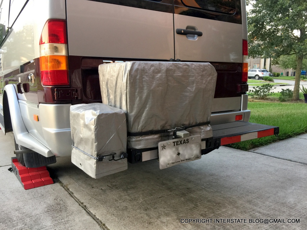
Airstream Interstate parking, all eight thousand pounds of her (that sentence is as long as the section of beach that I had all to myself).
Camper van on fire, at least figuratively.  
Every trip and every destination has pluses and minuses.  This was the plus for this one - I had a good square mile all to myself.
And the sunrise was even better than the sunset.  Here's the first peek above the horizon...
...and here's the Full Monty.
When I woke up, the beach was covered with freshly dead fish that had not been there the evening before.
They all appeared to be the same size and species. 
As soon as the seabirds discovered this windfall, there was a great pandemonium of activity as they gorged themselves.  But I could not get any decent phone pictures.  Birds in far-flung areas are not as tolerant of humans as those in urban areas.  They fly away before you even get remotely close.

Speaking of far-flung areas...
I finally got to test part of my new connectivity improvements.  And I was very pleased!  Those are actual "before" and "after" screengrabs of my iPhone's homepage.  Before I flipped the switch, and after I flipped the switch.  Thanks to Technomadia for that one!
(4) McFADDIN NATIONAL WILDLIFE REFUGE
(5) TEXAS POINT NATIONAL WILDLIFE REFUGE.

I did manage to speak to a human at their joint headquarters, and he was quite nice in explaining the management principles that apply to both refuges, and the reasons behind those decisions.  Which gave me some ideas for state and federal policy suggestions.  Which I will discuss in another blog post in the future.
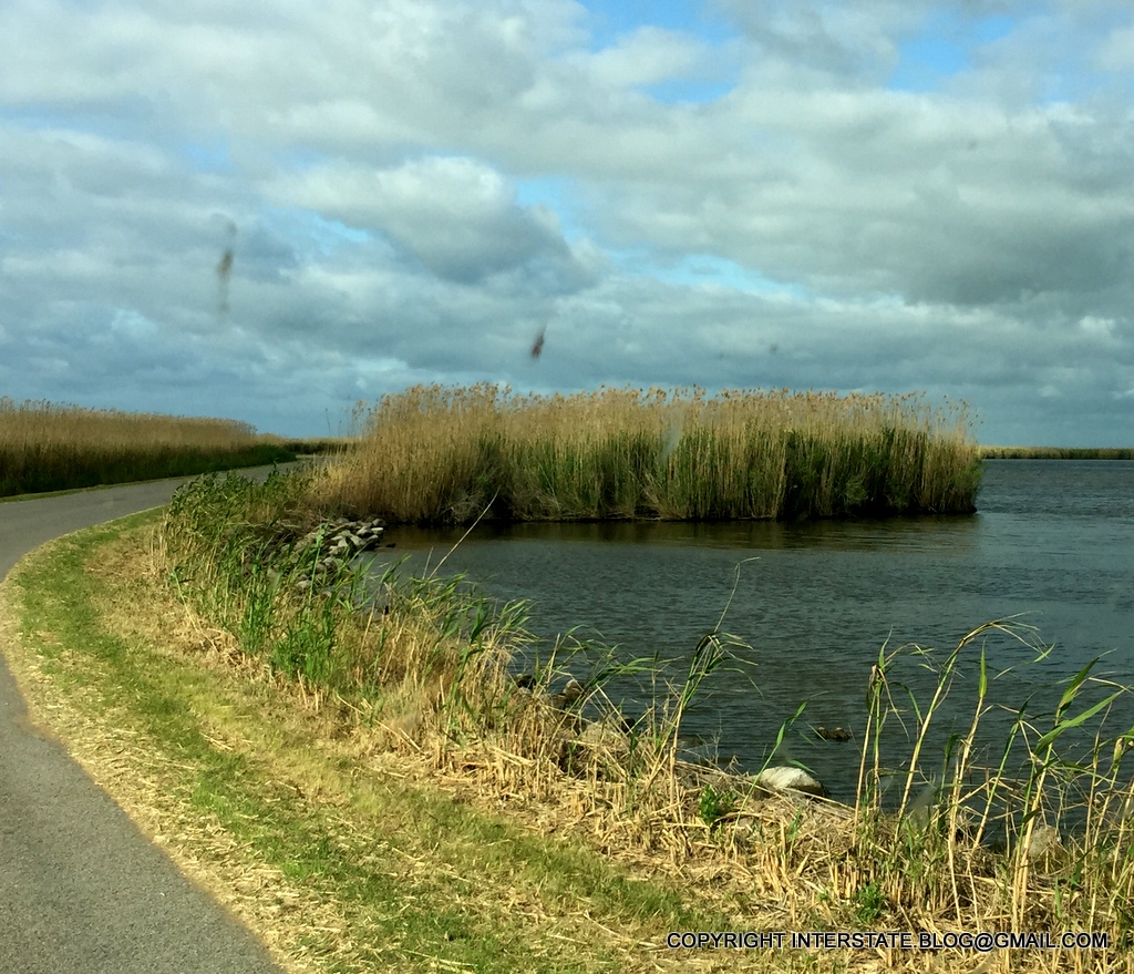
Much of McFaddin looks pretty much like this.  These refuges are largely set-asides for migrating birds.  
Another shot of McFaddin, with bugs squashed on my windshield for special effect.  
Neither refuge had any real pedestrian access.  They are mostly geared toward hunters and fishermen.
Texas Point had a short woodland trail.  Plenty of these were blooming.  They appear as if they might be a coastal rose species (based on what I know of wild roses that grow in Nova Scotia), although they did not smell like roses.  
My main aspiration when I go to an unpopulated area is that I might find some biking or hiking access.  I want to get out and move around over long distances and get serious exercise without motorized vehicles, and that's a very, very tall order in Texas, which is more than 95% private property (PDF link).
To that end, I went to where Texas-87 was blocked off.  It used to be a well-appreciated coastal highway joining High Island and Sabine Pass, but it was abandoned after yet another historical hurricane damaged it beyond repair for much of its coastal length.
I know what the western terminus of Texas-87 looks like - it's under water as a series of dissociated asphalt chunks, literally.  I was hoping that this eastern remnant might hold some promise for biking.  Alas, it doesn't look good, does it?  Hiking, maybe.  But Nature has pretty much taken it back by this time.

Driving back to Houston from this area is trippy in its own way.
In order to get in and out of Sabine Pass, you have to literally drive through a couple of Port Arthur refineries. 
Anyway, another successful road test of our lithium battery system and now our connectivity improvements also.  And some ideas for future endeavors came out of this trip, which I will discuss later.