 |
| It wasn't working for us: That white object extending upward from the rear of the vehicle is a Wilson Yagi directional antenna pointed toward a known (i.e., location-published) cellular source and cabled into the market's best booster which ultimately received absolutely nothing in the way of usable signal from this exercise and investment. |
We know that cellular transmission functions largely according to line of sight principles. There are some diffraction and reflection and other effects incorporated into the mix, but line of sight is the best bet, particularly as distances from the tower increase.
Tower details are public information and are published in both the United States and Canada. The same is true of topography. Theoretically, then, it should be a simple matter to determine a priori whether line of sight exists at any given location. And here's the endgame: If line of sight does not exist, how tall would a user's antenna mast need to be in order to achieve it?
I'm primarily interested in determining these facts with precision within the context of a property that we own in rural eastern Canada. However, for various reasons I will omit for brevity, that is a more complex determination, so I thought I would start off with a simple example where I've experienced cellular signal failure - Monahans Sandhills State Park in Texas.
 |
| It's a unique environment where the unprecedented small-scale topographic features play hell with connectivity. This is an aerial photo of the camping loop where I stayed. |
 |
| Sand-bogged?! I'd like to coin a new term: Cell-bogged. |
 |
| Good grief. Starving in the midst of plenty. Screengrabbed from Antennasearch.com |
You can see on the map above that there is one tower north of Monahans that is due west of the state park's campground. I chose that one upon which to base this analysis. Here are the stats on that tower according to Antennasearch.

This is where Hillmap comes in. This blog post by the site's creators describes how to use Hillmap, but I didn't find any reference to the source data, and that's important, as we shall see below.
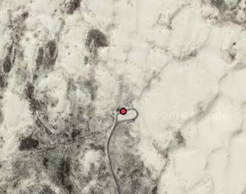
Here's a close-up of that tower's location on Antennasearch.

And here's the same close-up on Hillmap.
 |
| The blue line is tracing eastward toward the camp site. For those of you not familiar with Texas, all those squares are drill sites. This area is within the Permian Basin, an incredibly productive oil and gas reservoir. |
Now, here's a summary of the resulting topographic profile between this particular tower and the referenced camp site (map and resulting topographic profile produced by Hillmap, as annotated by me):
 |
| Tap this image to expand for clarity. |
Hillmap was designed primarily as a backcountry hiking reference. High degrees of accuracy are not necessarily needed for the fulfillment of their mission. Again, I didn't find a statement regarding the source of their baseline elevation data.
I do realize that I've predicated this assessment on one tower that I wasn't able to confirm in the field as my actual source tower. There are other factors that can influence line of sight, such as, the position on the tower of the cellular equipment. The higher up a tower, the more expensive the placement. Just because a tower is stated as 2,972 feet tall does not mean that the equipment itself has been placed on or near that height. My carrier is the cellular giant Verizon, though, and I would expect their equipment to be commanding premium spots on towers.
Lastly, it's important to incorporate ground truth into any assessment such as this. The ground truth in this case suggests that there is not necessarily sufficient resolution in the Hillmap database to accurately reflect fine-scale reality. Here's a view to the west with my rig visible at intermediate range - in other words, looking generally in the direction of the referenced tower. The highly-localized topography suggests that the rig may indeed fail where line of sight is concerned - there's a large sand hill to the west of it.
 |
| The camp sites are at the bottom of a sandy bowl. |
In sooth, we need better data than what I've shown here if we are to do this type of analysis with accuracy sufficient to justify purchase decisions (which antenna, which mast, etc.). If anyone has any source material suggestions or procedures that are superior to what I've presented here, please email me via interstate.blog -at- gmail. Thanks, and I will update this post in the future if I identify better evaluation methods.
 |
| My non-sand-bogged pooch enjoying the Monahans dunes at sunset. |
No comments:
Post a Comment