A few pics here to wrap up the scenic part of this discourse, and then I will follow with a "lessons learned" blog post.
 |
| Franey is the type of trail that I wish I could hike every Saturday morning, just for the exercise, but at a minimum, we do the 5 to 6 mile mountain loop every time we are in the area. This was the one time I did not take my DSLR camera with me. Lo and behold, we discovered that Parks Canada had cleared out the surrounding trees such that the full regional view was finally attainable. This type of clearing had not occurred in anyone's memory in at least 30 or 40 years (we spoke with other climbers at the top). My luck! No good camera! Just the iPhone. |
 |
| The sapphire blue of the ocean off this coastline is my absolute favorite color. I even bought these hiking boots because they had that color in them. Of course, that was many rough miles ago, and now mostly what's visible is dirt rather than the original blue. |
This year, we really wanted to do another local hike called the
Kauzmann Trail, but it turned out to be the one time that the back roads ended up defeating us.
 |
| The shadows make it a bit difficult to see, but there's a wash-out in the middle of this access road. At our lowest point, we have 5 inches of clearance with the Interstate because of the way the engine exhaust was re-routed around the generator. Furthermore, the Interstate is longer than the road is wide, so there's no turning around once one gets into a place like this - backing out is required. We chose not to risk damaging the vehicle in such a remote location, and gave up on this hike. |
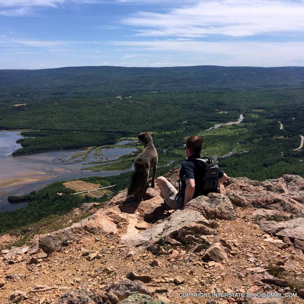
We therefore ended up revisiting a little known peak informally called Tenerife, which we had discovered only the year before.
 |
She looks brave in this photo, but our dog actually disliked this hike intensely. It was too steep and treacherous for her, and she kept inserting herself between my legs as I was trying to hike, which caused me no end of laughter.
To the left of the dog is a cleared oblong field at the base of the mountain. To the left of that is a small parking area. A spec of light color in that parking lot is our Interstate. Very small, isn't it? This is a tough hike, not for the faint of heart (or body). |
 |
| The winds are so strong and so continuous on top of Tenerife that the most exposed trees have branches growing on only one side. |
 |
| We also hiked to the top of Broad Cove Mountain, which is a much less challenging trail. That's Warren Lake visible below and we usually hike around it also, but... |
...an unprecedented development forced us to end our mountain hiking earlier than planned.
 |
| Parks Canada closed the eastern half of the park due to elevated fire danger. |
For me, the ideal vacation is all about exercise, so this was a bummer.
 |
| At least I managed to get some fries and gravy before everything shut down. This is a local delicacy and don't even talk to me about poutine - I can't stand that stuff. This is the regional variant - usually turkey gravy, with lots of white vinegar. Love it. |
 |
With the park closed, we set off down the Cabot Trail for the long, long, LONG drive back to Houston.
-- To be continued under the heading Lessons Learned. -- |


No comments:
Post a Comment